

Route: circular trail around Motovun
The trail starts at the foot of Motovun, on the main road, where you turn left towards the petrol station and then descend to the Parenzana route. When you reach a lay-by on the Parenzana, turn left and you will go through a tunnel. Be careful here because of the uneven surface!
When you reach the asphalt road, turn right in the direction of Brkač, and, after about three hundred metres, turn right again. Before entering the village, turn left from the asphalt road onto the forest path along the dry stone wall. You will reach a fork of four forest paths where you turn right. After 100 m, keep to the right and you will soon start the descent towards the golf driving range.
At the end of the descent, turn right and continue riding alongside the golf course in the direction of Motovun. You will then join a macadam road on the left and continue in the same direction. When you reach the asphalt road, continue straight and after 100 m turn left off the main road towards Zamask. Turn left over the bridge, then slightly left across the field towards the Mirna embankment, where you will ride along the embankment.
When you reach the fork, continue over the small bridge and enter the forest slightly to the right (caution: do not turn sharply to the right along the embankment, but go straight and turn slightly to the right).
After riding through the forest, there is a point of divergence. You have 2 options here:
1. turn right along the stream, ride alongside the stream and exit the forest returning to the bridge where you entered the forest earlier. Turn left over the bridge, then immediately left again and continue along the embankment on the right side of the riverbed. When you reach the asphalt road and the bridge, turn left and then right onto the dirt track along the riverbed. Continue straight.
2. if you continue straight after riding through the forest, the demanding climb to Kal begins. After that, you join the route described under 1. And, from the point where you join it, continue to the end as described below:
You come out onto an asphalt road where you turn right, and then continue straight, crossing onto a macadam road alongside the riverbed. Turn right over the little bridge and continue alongside the riverbed in the direction of Motovun. At the junction with the macadam road, turn left and continue uphill towards Motovun. You will come to the lay-by on the Parenzana route and a train station, where you turn left, going up the asphalted track. When you come out onto the main road, turn right and you will reach the carpark on the right, where the trail ends.
Motovun forest, a famous truffle habitat, where, according to legend, the giant Veli Jože lived
The Mirna river, the longest (and in many ways the most beautiful) river in Istria
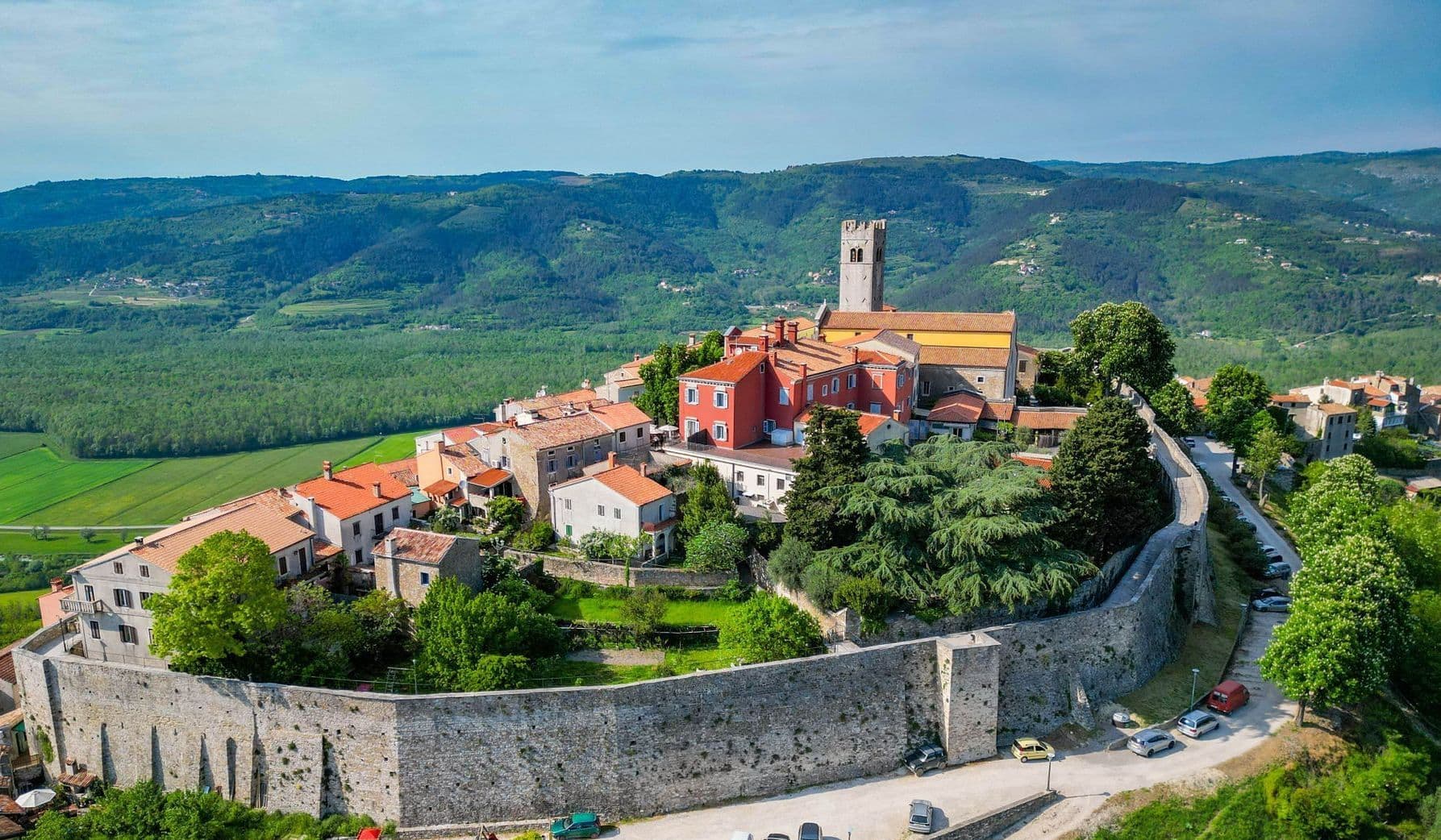
the fortified city of Motovun where you can walk along the walls and stone streets or visit the interactive History in Motion centre
And don't forget: The maps and routes on this Internet page only provide informative material and are used at your own risk.


Visit on your route


Destinations
Additional Information


©2026 Colours of Istria. All rights reserved. No part of this site may be reproduced without our written permission.


.jpg&w=3840&q=75)
.jpg&w=3840&q=75)

.jpg&w=3840&q=75)


